
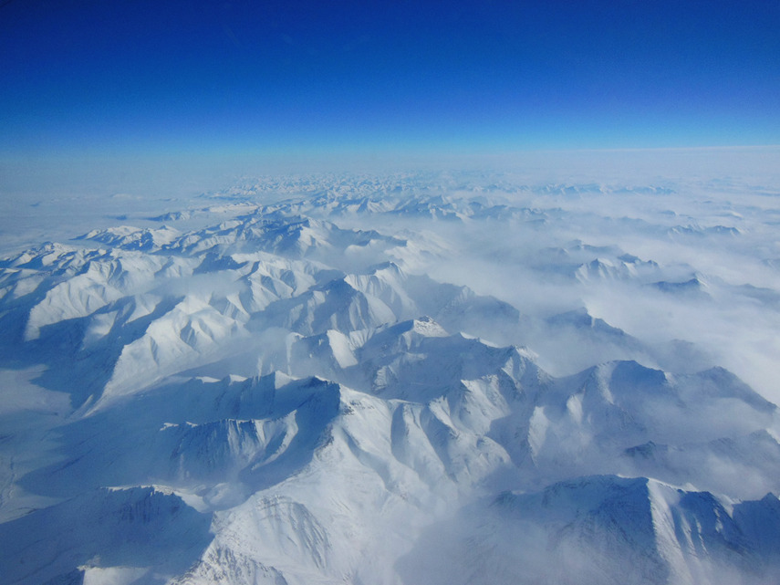
Photo of the day: Ice scientist snaps stunning aerial view of Alaskan
A vast range of snowy mountains are seen from a NASA P-3B airplane on March 21 during a data-gathering flight between Thule, Greenland and Fairbanks, Alaska. The photo was captured by Christy Hansen, a scientist and project manager of NASA’s Operation IceBridge, an airborne science mission studying Earth’s polar ice. Over the course of the mission, Hansen and her team of scientists recorded data on polar ice sheets while flying over sea ice near the Arctic circle.
 some-places liked this
  jarvene liked this
  in-3-2-swaggie liked this rey0812 liked this
  profconfessor liked this
 O: wow!