99% Invisible is a tiny radio show about design, architecture & the 99% invisible activity that shapes our world. New episodes every Tuesday on 99pi.org. This is just the tumblr.
Wherever there is sufficient demand to move between two points of differing elevation, there are stairs. In some hilly neighborhoods of California–if you know where to look–you’ll find public, outdoor staircases.
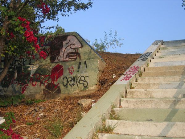
The large number of often hidden, public staircases is part of what makes California so great. San Francisco’s tourist-crushing Filbert Steps to Coit Tower are not to be handled lightly. The Monument Way staircase just off the corner of 17th and Clayton leads the intrepid walker to what used to be Sutro’s Triumph of Light and Liberty statute. There’s just something about a secret staircase that beckons you to go out of your way to use it.
(Credit: Charles Fleming)
Charles Fleming is one of the world experts of coastal California’s public stairs. Charles has documented and mapped walking routes through nearly every useable public staircase in San Francisco’s East Bay, as well as in Los Angeles (where he lives). He published his findings in two walking guides, appropriately titled Secret Stairs.
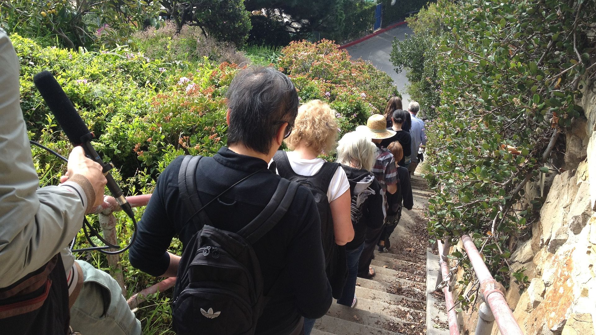
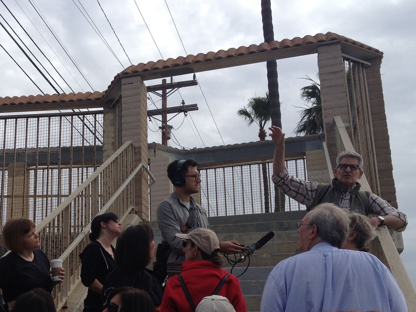
Producer Sam Greenspan met with Charles in the Pacific Palisades, where people from all over Los Angeles had gathered to attend one of Charles’ monthly stair walks.
Charles’s fascination with public stairs began with a basic need to walk. “I was trying to walk my way out of a surgery,” he says. “I had had two hip replacements and two spinal surgeries in the space of about 6 years, and I was up for a third spinal surgery. I simply couldn’t face it…so I told the surgeon I’m not coming, because I had found that a little bit of walking relieved the pain I was in.”
Charles started walking flat streets, the moved to hilly streets, and eventually graduated to the stairs. He looked for a city inventory of all the staircases, but couldn’t find one. So he started making his own.
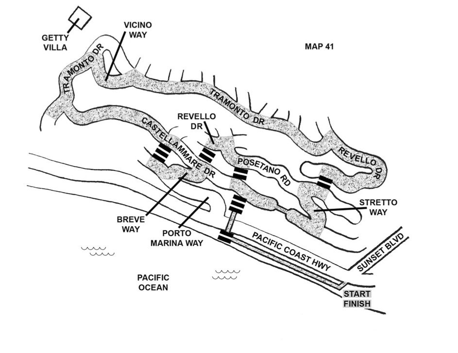
(Walk #41 from Secret Stairs, the route Charles took Sam through. Credit: Charles Fleming.)
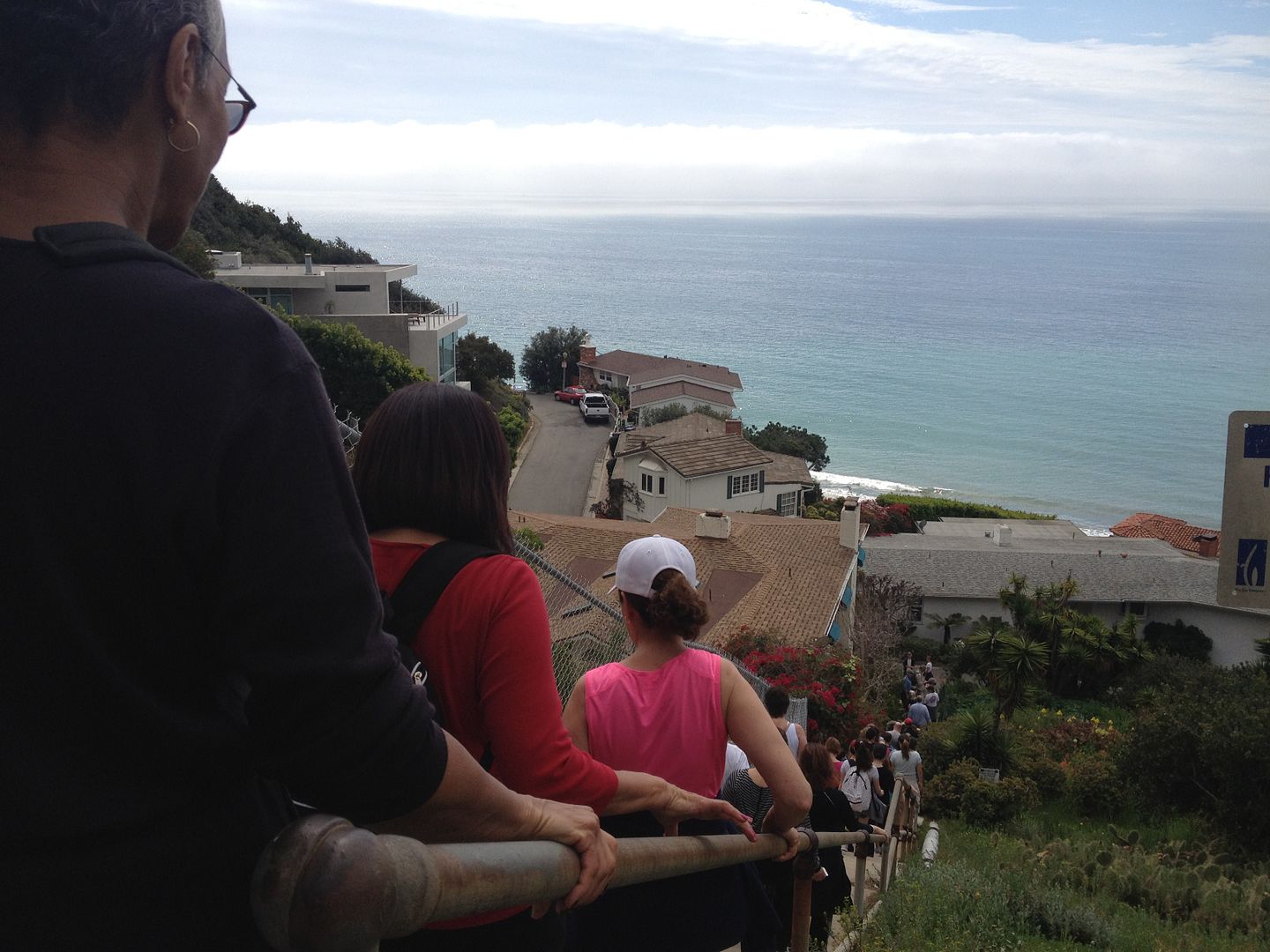
The staircases are generally either from the 1920s boom years or from the Works Progress Administration in the 1940s. They were built because developers in hilly areas needed to find a way for prospective home buyers to get down from their houses to a school, church, or streetcar line. But the Depression, and then World War II, halted most staircase construction.
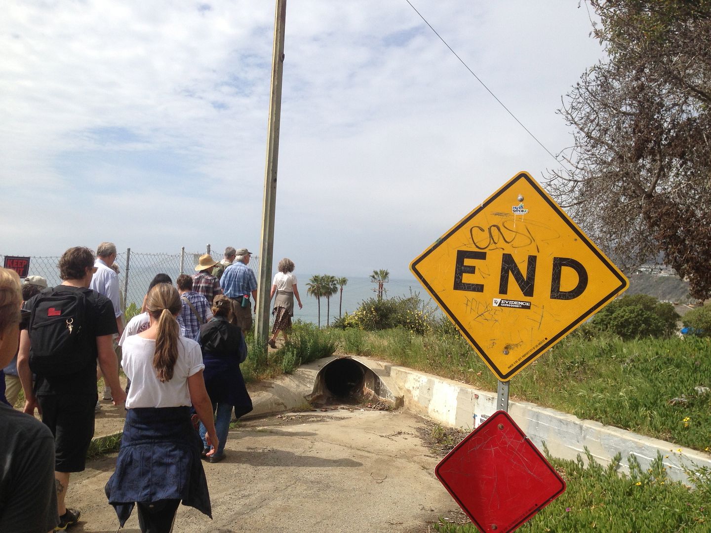
When Eric Molinsky lived in Los Angeles, he kept hearing this story about a bygone transportation system called the Red Car. The Red Car, he was told, had been this amazing network of streetcars that connected the city–until a car company bought it, dismantled it, and forced a dependency on freeways.
If this sounds familiar, it might be because it was the evil scheme revealed at the end of the Robert Zemeckis’s 1988 movie, Who Framed Roger Rabbit?
But like most legends, the one that Eric heard about the Red Car is not entirely accurate. It’s true that Los Angeles did have an extensive mass transit system called the Red Car, which at one time ran on 1,100 miles of track–about 25 percent more more track mileage than New York City has today, a century later.
But the Red Car wasn’t the victim of a conspiracy. The Red Car was the conspiracy.
Our reporter Eric Molinsky spoke with historian Bill Friedricks, who says that to understand the Red Car, you first need to know about Henry Huntington, one of the major power brokers of Los Angeles. If you’ve ever heard of Huntington Beach, Huntington Park, or the Huntington Library, this is that Huntington.
Henry Huntington was the nephew of railroad magnate Collis Huntington, who mentored Henry and taught him the family business. When Collis Huntington died in 1900, Henry expected that he would inherit his uncle’s company, Southern Pacific. But Southern Pacific’s board didn’t want another Huntington in charge. They forced him out, but gave him a $15 million payout (about $400 million today).
Henry Huntington took his money and headed for Los Angeles. He purchased the biggest transportation system in the city, The Los Angeles Railway (LARy), and then incorporated it into a new company called Pacific Electric. Huntington also started building hundreds of subdivisions on the periphery of Los Angeles, and used Pacific Electric trains–bright red trolleys–to connect the subdivisions to downtown Los Angeles.
Over time, though, Huntington had built so many subdivisions that his Red Car couldn’t do a good enough job connecting the city’s disparate areas. The Red Car was never designed to be a comprehensive system like the New York City Subway; rather, it existed primarily to get people in and out of Huntington’s subdivisions. Angelenos who could afford cars found it was easier to get around by driving. The Red Car fell into disrepair, and was mocked as a “slum on wheels.”
Eventually, Southern Pacific (the company Huntington thought he would inherit from his uncle Hollis) bought Pacific Electric, and in 1926 they offered Los Angles a massive plan to use public dollars to build subways and elevated trains around downtown L.A. But California voters didn’t trust Southern Pacific, which had meddled in California politics for so long that people called it “The Octopus.” The people voted against the plan.
Red Car routes were decommissioned, and bus routes and freeways would eventually replace the Red Car entirely. The last Red Car ran in 1961.
But if you look carefully, you can still spot evidence of the old Pacific Electric Railroad company, especially around Santa Monica.
To find out more about the Red Car, check out Bill Friedrick’s book, Henry E. Huntington and the Creation of Southern California (which you can read, in entirety, for free!).
**Subscribe to the 99% Invisible podcast in iTunes or the podcatcher of your choice.**
Kowloon Walled City was the densest place in the world, ever.
(“Walled City Night Views (from SW Corner), 1987.” Greg Girard.)
By its peak in the 1990s, the 6.5 acre Kowloon Walled City was home to at least 33,000 people (with estimates of up to 50,000). That’s a population density of at least 3.2 million per square mile. For New York City to get that dense, every man, woman, and child living in Texas would have to move to Manhattan.
To put it another way, think about living in a 1,200 square foot home. Then imagine yourself living with 9 other people. Then imagine that your building is only one unit of a twelve-story building, and every other unit is as full as yours. Then imagine hundreds those buildings crammed together in a space the size of four football fields.
We can’t really imagine it, either.
(Credit: Ian Lambot)
Kowloon Walled City began as a military fort in Kowloon, a region in mainland China. In 1898, China signed a land lease with Great Britain, giving the British control of Hong Kong, Kowloon, and other nearby territories. But the lease stipulated that the fort in Kowloon would remain under Chinese jurisdiction.
Over time, the fort became abandoned, leaving the area subject to neither Chinese nor British authority. This legal gray zone was attractive to displaced and marginalized people. Thousands of people moved there after the war with Japan broke out in 1937. Even more people moved there after the Communist Revolution. It attracted gangsters, drug addicts, sex workers, and refugees. And it also drew a lot of normal people from all over China who saw opportunity there.
They built the city building by building, first blanketing the area of the fort, then building vertically.
(Left: “West Side Street (Overhead Pipes), 1990." Right: "Water Standpipe (Man Washing), 1989." Greg Girard.)
Buildings were packed together so tightly in the Walled City that the alleys were nearly pitch-black in the day time. Electricity and water were brought in by illegal or informal means.
There was no garbage collection, so people pitched their trash out of their windows.
The Walled City gained a reputation as a sort of den of iniquity–there were high levels of prostitution, gambling, mafia activity, and rampant unlicensed dentistry.
("Walled City Dentist Window, 1989.” Greg Girard.)
But an order did emerge. There was an informal kindergarten. A resident’s organization settled disputes. And there was lots of industry.
(Left: “Workers in a Fishball Factory, 1987." Right: "Worker in Metalwork Shop, 1988." Greg Girard.)
Kowloon Walled City was torn down in 1993. Today, it’s Kowloon Walled City Park. Most traces of the city are gone, though there is a model of the city cast in bronze.
But the memory of the city lives on. It was featured in the non-verbal film Baraka, and plays a cameo role in Bloodsport.
It’s also served as the setting in a number of video games, including most recently Call of Duty: Black Ops
If you still can’t get enough of Kowloon Walled City, here’s an hour-long documentary (in German, with English subtitles)
This week’s episode was produced by Nick van der Kolk (whom you may remember from Episode #21). He spoke with photographer Greg Girard and architect Aaron Tan, who both spent time in the Walled City. Nick also talked to as Brian Douglas, who helped design Call of Duty: Black Ops.
In European city, you can usually tell where the oldest part of town is. It’s most likely at the center, pinpointed by some grand church, with layers of progressively newer buildings spiraling out from it.
This pattern holds true in the Netherlands, according to an interactive map of all 9,866,539 buildings in the entire country. A developer at Amsterdam’s Waag Society, an institute for art, science and technology, built this infographic on top of the CitySDK data distribution platform.
Newer buildings are blue, old buildings are red, and other buildings are gradients in between.
It’s a little harder to approximate the age of building in North America if it doesn’t have a plaque in front.
However! If you live in Brooklyn or Portland, you’re in luck - not just because you live in a great place, but also because you’ve got interactive maps of your cities, arranged by date of construction.
The color schemes and designs of these maps are interesting as well, but that’s a whole other kettle of fish.
Okay Brooklyn, Portland, and the Netherlands, go out and find the old gems/ unmask the new knockoffs around your neighborhood!
If your town doesn’t have an interactive age map, here’s how to go make one.