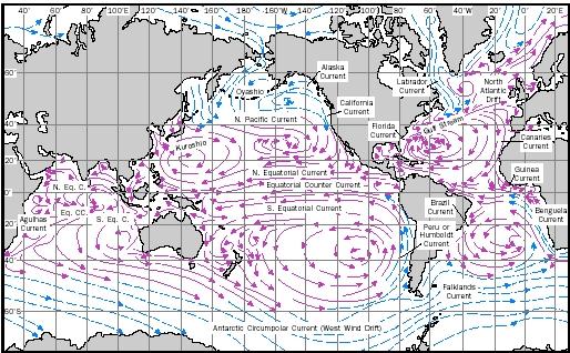
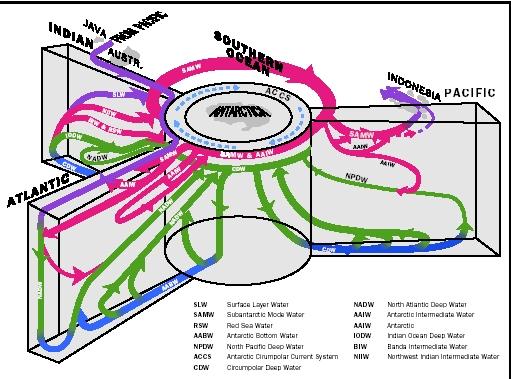
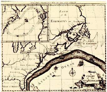
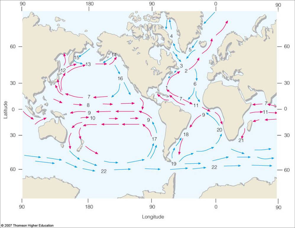
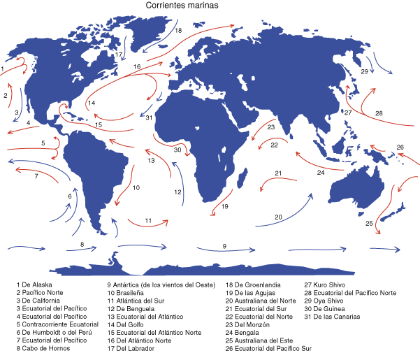
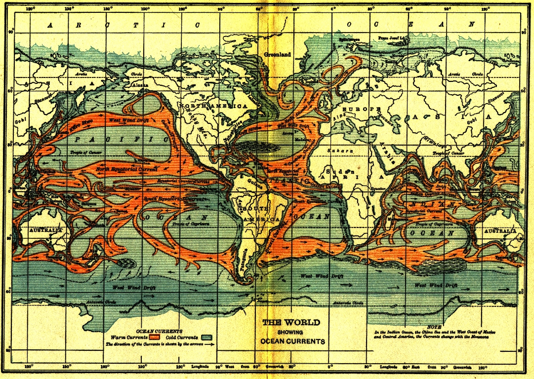
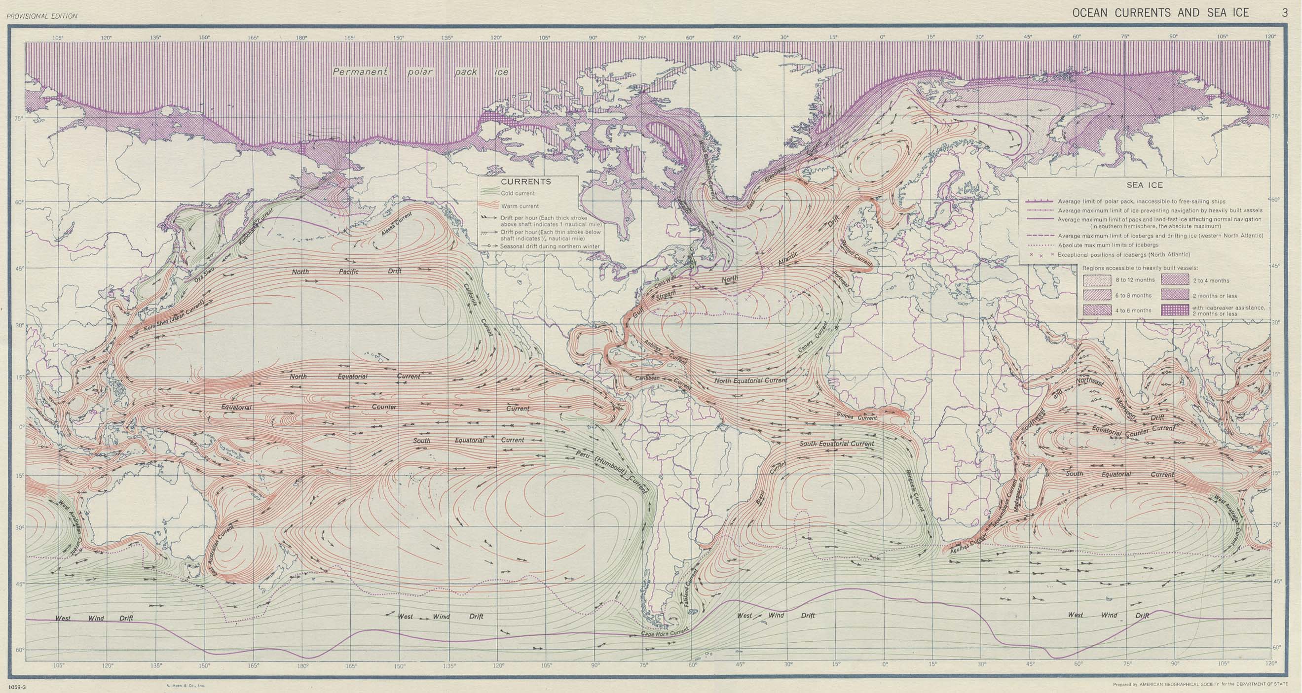
Just some pictures of ocean currents.


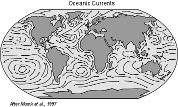


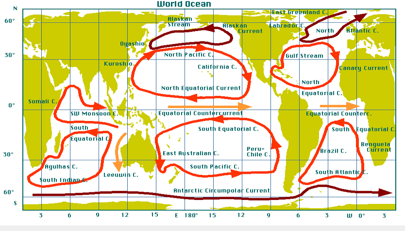


I love looking at oceanographic maps because the water-covered parts of the globe are so often de-emphasised–I guess because most of us humans live on land–even though most of the interesting things happening on Earth involve water.
Oceanographic maps are like looking at the world inside-out–perhaps as it should be seen, not from our perspective but from the majority perspective.


 http://upload.wikimedia.org/wikipedia/commons/7/79/Perpetual_Ocean.ogv

Maths concepts:
- vector fields on S²
- topology; connected spaces
- convection cells, Rayleigh number
- According to Ole Nielsen, ocean waves are trochoids, not sine waves:


- fluid mechanics
- differentials, gradient
- boundary & flow
- discrete versions? (maybe a graph … or see the discrete geometry paper I posted)
A great lecture on this topic was given by Stephen C Stearns and recorded & displayed by the people at AcademicEarth.org.
West coasts are really different the world over because, duh, the Earth is spinning. (Eastward.) That throws stuff up on the shores of the west (e.g. Nitrogen on one of the Chilean coasts which ends up becoming the world’s major source of guano) You also get a different clockwise/anticlockwise circulation of the ocean currents in the Northern and Southern hemispheres because that eastward force pushes differently below -vs- above the equator. Pretty simple logic and it makes things be the way they are.